Mount Iron Track
Name |
Mount Iron Track |
Location |
Wanaka |
Co-ordinates |
1295376 5043881 |
Alternative co-ordinates |
|
Configuration |
Loop |
Distance |
4.5 km |
Status |
Off-leash |
Grade |
Moderate |
Access |
Access point on SH84, ca 500 metres west of junction with SH6 |
Description |
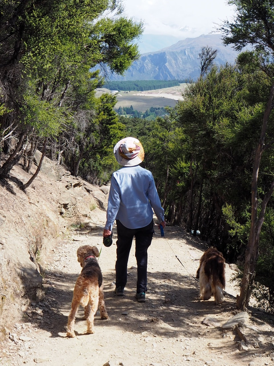
A great climb on a well-graded path up a conical hill on the outskirts of Wanaka. The path bristles with rather too many threatening notices to make you feel welcome, and the top of the hill has been somewhat scarred and scoured by an excessive of feet. The view. too, is somewhat depressing because of the gross and insensitive development that's happening around Wanaka. But somehow, despite all that, the walk feels good. |
Connecting tracks |
|
Further information |
Although the Wanaka area offers a number of dog-friendly walks, almost all of them are confined to the river valleys and are flat walks that follow the gravel terraces. The one real exception is the Mount Iron walkway – a 90 minute loop walk which gives the opportunity for a real work-out, and to stretch the muscles that other walks in the area don’t reach.
|
There are two main starting points, one opposite Puzzling World on SH6 close to the junction with the Albert Town Road, the other about 250 metres west, at the Mount Iron car park. The former is probably the better option, for there are shady trees to keep the car cool while you’re away, whereas the Mount Iron car park is a barren desert. You can also obviously follow the walk either clockwise or anticlockwise. Clockwise is better if you don’t like steep ascents, anti-clockwise if it’s downhill that gets you.
Assuming you’re taking a clockwise route, and starting from Puzzling World, the first stretch of the walk is an easy stroll along a grit path to the Mount Iron car park, where you turn and head for the hill. For the most part, it’s a steady climb through grazed grassland (the main grazers being rabbits one suspects, for the area is teeming with them), with occasional passages through kanuka scrub. The path crosses private land for much of the uphill route, so it bristles with the inevitable signs reminding you of the fact, and to keep to the path and to keep your dog on a leash and that there are minefields to left and right (I lied about the last of these). The main effect, of course, is to channel the thousands of feet that must do this walk each year into a narrow zone that is now becoming rutted and worn. One day, land-owners in New Zealand – and the recreational planners from the local authority and DoC – will realise that letting the public walk more freely on land like this spreads the load so that it’s below the carrying capacity of the vegetation and soil, with the consequence that there’s much less damage. |
|
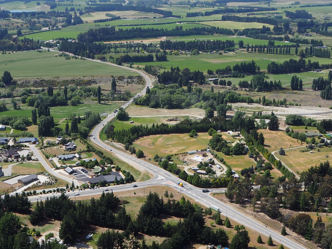
The soul-less sprawl of the future town.
|
From the top of the hill there are some good views to the surrounding river valleys and mountains, in one direction across the rather soul-less sprawl of Wanaka, and in another across the scraped-away foundations for the further sprawl of the future town. The downhill route, though, is mainly on conservation land, so the warning signs are fewer and the path feels less constraining for dogs and owners alike. After a few hundred metres, the path steepens and becomes hard rock underfoot with a thin gravel veneer as it zig-zags down the hillside. Some care is needed here, for there are often falls to one side or the other, but in the steepest section there’s a welcome flight of steps. It’s only when you get to the bottom, however, and look back that you see the cliff that you’ve descended. Now, it’s a gentle walk around the north and east sides of the hill, back to the car park.
|
Hover on the map to zoom in