Opihi River Walkway
Name |
Opihi River Walkway |
Location |
Fairlie |
Co-ordinates |
1426675 5115172 |
Alternative co-ordinates |
1419124 5122204 |
Configuration |
Linear |
Distance |
14 km |
Status |
Off-leash |
Grade |
Easy |
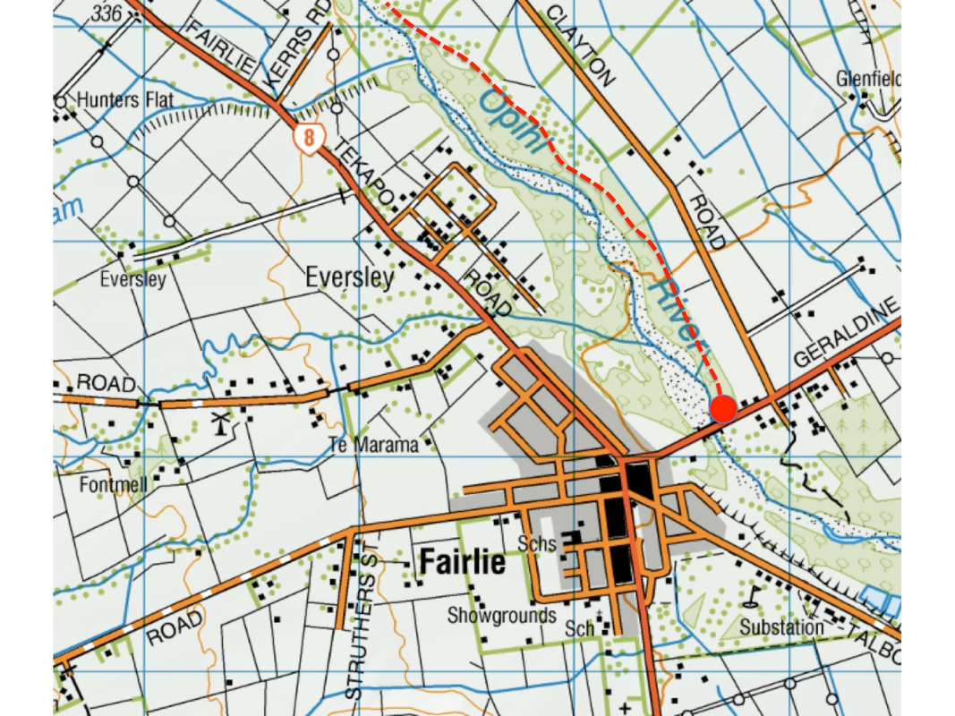
Access |
Three main options: at Kimbell in the west, Fairlie in the middle or at the end of Opihi Gorge Road, to the east. Easiest access is on SH79 (Geraldine-Fairlie Highway) about 200 metres north-east of the main cross-roads. Parking area just beyond bridge, on the north side of the road. Walkway upstream to Kimbell starts opposite; to head downstream, cross the bridge and take track beside campsite. |
Description |
A gentle but lengthy amble, following the Opihi River upstream or downstream from Fairlie. |
Connecting tracks |
|
Further information |
Fairlie is one of those small New Zealand towns that seems to have a big heart and to be full of buzz. As well as a good range of cafes and local shops, it sports a beautiful series of photographs in its main street, highlighting the landscape of the area. It also offers as range of parks and dog-friendly walkways.
One of the best - and the longest - is the walk along the Opihi River. This 12 km track runs from Fairlee to Kimbel, and can be accessed from either end. The walk is easy, off-leash, and well sign-posted. The vegetation is not lush and is in some ways no more than rather unkempt secondary growth - with lots of Old Man's Beard/Travellers' Joy and a scatter of dying trees. But the birdlife is rich and songful, and the river is always nearby, and at intervals the tracks winds out to the adjacent field edge to give sunny stretches beside grassland or crops. After the long haul over Liindis Pass and the Lake Tekapo road, or south from Geraldine, this is a really good opportunity to stretch the legs and exercise the dogs.
One of the best - and the longest - is the walk along the Opihi River. This 12 km track runs from Fairlee to Kimbel, and can be accessed from either end. The walk is easy, off-leash, and well sign-posted. The vegetation is not lush and is in some ways no more than rather unkempt secondary growth - with lots of Old Man's Beard/Travellers' Joy and a scatter of dying trees. But the birdlife is rich and songful, and the river is always nearby, and at intervals the tracks winds out to the adjacent field edge to give sunny stretches beside grassland or crops. After the long haul over Liindis Pass and the Lake Tekapo road, or south from Geraldine, this is a really good opportunity to stretch the legs and exercise the dogs.