Sign of the Kiwi
Name |
Sign of the Kiwi |
Location |
Port Hills |
Co-ordinates |
1571391 5171801 |
Alternative co-ordinates |
|
Configuration |
Network |
Distance |
30 km |
Status |
Mainly off-leash |
Grade |
Moderate |
Access |
The Sign of the Kiwi, at the junction of Dyers Pass Road and Summit Road, ca. 2km west of Governors Bay. |
Description |
From the Sign of the Kiwi there's a wide range of options for long and lovely loop walks both along the ridgeline (the crater rim) and northwards down towards the southern fringes of Christchurch. For a really good loop walk, take in Bowenvale and the track beside Dyers Pass Road. |
Connecting tracks |
Victoria Park (via Bowenvale); Sign of the Bellbird (via Crater Rim south); Mount Vernon (via Crater Rim, east) |
Further information |
Of the four refreshment stations created by Harry Ell - the man responsible for opening up the Port Hills to the public - two still operate as providers of food. One is the Sign of the Taheke, at the edge of Cashmere and near to Victoria Park; the other is the Sign of the Kiwi, at the junction of Summit and Dyers Pass roads.
With its central location on Summit Road, the Sign of the Kiwi is an especially good place to start or end walks on the Port Hills. Westwards there is a pleasant walk to the next way-station along the Rim - the Sign of the Bellbird. Northwards, there are good tracks that drop down into Victoria Park. Eastwards, the Crater Rim walkway runs along the ridgeline for ten or more kilometres, until it reaches Evans Pass and links with the walkway around Godley Head. And on the way, there are numerous offshoots offering long loop routes either north to the suburbs of Christchurch, or south to Lyttleton and Governors Bay. On the Crater Rim path, the signs indicate that dogs can be off-leash; on most of the side tracks, however, and in some sections on the Crater Rim, especially where sheep are being grazed, the rule is on-leash, so stay on the lookout.
With its central location on Summit Road, the Sign of the Kiwi is an especially good place to start or end walks on the Port Hills. Westwards there is a pleasant walk to the next way-station along the Rim - the Sign of the Bellbird. Northwards, there are good tracks that drop down into Victoria Park. Eastwards, the Crater Rim walkway runs along the ridgeline for ten or more kilometres, until it reaches Evans Pass and links with the walkway around Godley Head. And on the way, there are numerous offshoots offering long loop routes either north to the suburbs of Christchurch, or south to Lyttleton and Governors Bay. On the Crater Rim path, the signs indicate that dogs can be off-leash; on most of the side tracks, however, and in some sections on the Crater Rim, especially where sheep are being grazed, the rule is on-leash, so stay on the lookout.
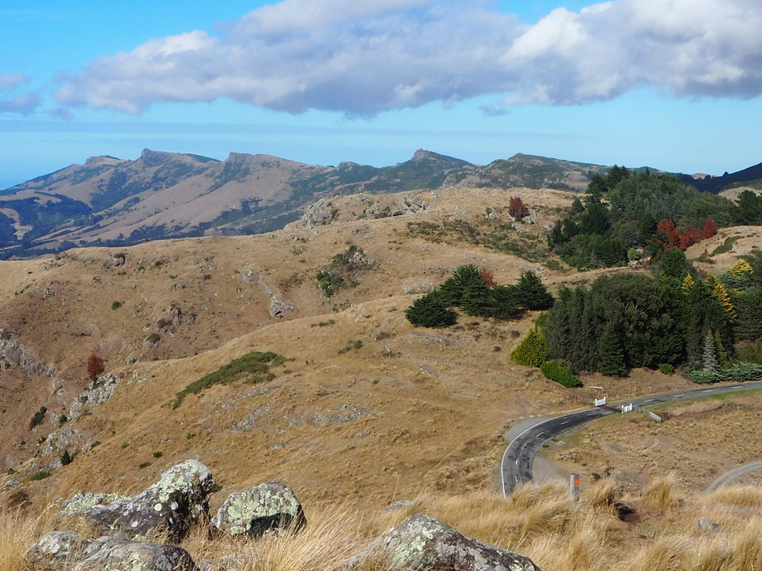
The Crater Rim, from Mount Vernon
|
For a mid-length walk of 3-4 hours, a good section runs between the Sign of the Kiwi and the Rapaki carpark on the saddle beyond Mount Vernon. If you want to break the trip half-way through, it's sensible to start at the Rapaki Track carpark and walk westwards. Following the Crater Rim walkway, the walk starts in this case with a steady climb up to the summit of Mount vernon, before an even steeper descent down to the mextr carpark. After that, it's a pleasant stroll through bush and tussock grass until you reach the Bowendale carpark, where the track splits. Mitchells Track is especially inviting, because it avoids the steep climb onto Sugarloaf. but instead takes yous around the cliffs and crags below the summit, on a well-made track which offers good views of the head of Lytttleton Harbour. Soon after that, there's a ig-zag descent to the Sign of the Kiwi and coffee or lunch.
|
If you want to defer that pleasure - or find a diversion to separate the two - then you can continue along Crater Rim walkway, staying just above Summit Road, past the first small carpark and on for about 700 metres until you pass one, and then soon after reach a second, unsigned track on your left (but identified by a post). Take this and you can circle around Coronatioin Hill. descending ,mmuch of the way, and gradually bearing left, and yoiu'll come out above Dyers Pass Road. Stay on the track and you'll follow a gentle track down to the Kiwi again, ready now for lunch.
For the return journey there are lots of options. Yoiu can return the way you came, via Mitchells Track. You can slog up to the top of Sugarloaf on Gilpins Track, or you can take Cedrics Track aroun d the westerm side of Sugarloaf to the carpark just below the communications tower, then down to Bowendale carpark, on Summit Road. To avoid retracing your steps there, cross the road and take the shared cycle track, staying on the upper branch whenever you get a choice, and crossing several small cattle grids (where the dogs will have to learn to 'walk the plank' which has conveniently been put there for bicycles) and you'll eventually arrive back at the Mount Vernon carpark. There you cross Summit Road and follow the lowermost track, left. which runs just above the road and takes tou around Mount Vernon baxck to your start.
In my opinion, the Rapaki to Sign of the Kiwi walk is a must. But there are numerous other dog-friendly options ffrom the Sign of the Kiwi, including sahorter loop walks of 2-5 km along Cedrics, Gilpins or Mitchells tracks, or on the Coronation Hill Circuit, or a longer walk down Thompsons Track to Victoria Park, then back via Bowenvale Track or one of its offshoots. It's one of those areas to which you can return time and trime again, and each time discover something new.
Click on the map to zoom