And the dog came too... dog walks in New Zealand
  • Home
  • Introduction
  • Notes for Users
  • Alarums and Excursions!!
  • South Island
    • North-West >
      • Atua Stream Walk
      • Barnicoat
      • Ben Nevis
      • Botanical Hill
      • Boulder Bank
      • Brooklyn
      • Collingwood Beach
      • Collingwood Cemetery
      • Cotterell Road
      • Dellside
      • Dicker Road
      • Dominion Flats
      • Eves Valley Road
      • Faulkner Bush
      • Grampians
      • Great Taste Trail - Richmond
      • Great Taste Trail - Kohatu
      • Great Taste Trail - Wakefield
      • Hacket Valley
      • Hoddy Estuary Reserve
      • Hoddy Road
      • Kawatiri Rail Tunnel walk
      • Kina Beach
      • Maitai Valley
      • Mapua Headland
      • Marahau Beach
      • Marahau Forest
      • Mead Stream
      • Milnthorpe Forest
      • Motueka Inlet
      • Motueka Spit
      • Pakawau Beach
      • Paton's Rock
      • Paynes Ford Tramline Track
      • Pearse Valley
      • Pohara Beach
      • Rameka Creek
      • Red Hills
      • Ridgeview Road Walkway
      • Robson Reserve
      • Rough Island
      • Sharlands
      • Split Apple Rock
      • Stagecoach Road
      • St Arnaud Loop Walk
      • Tahunanui Beach
      • Tantragee
      • Tasman View Road
      • Teetotal
      • Two Rivers
      • Waimea Fish-Out Ponds
      • Waimea River Trail
      • Wairoa River Left Branch
      • Waiwhero Forest
      • Waiwhero Ridge
    • North-East >
      • Archer's Track
      • Blairich Reserve
      • Cullen Creek
      • Cullen Point
      • Davies Bay Track
      • Esson's Valley Tracks
      • Goulter River
      • Grovetown Lagoon
      • Half Moon Track
      • Kotuku Trail
      • Lake Chalice
      • Link Trail East
      • Link Trail West
      • Lower Wairau
      • Mount Baldy and Mount Royal
      • Mount Barrett Walkway
      • Mount Fell
      • Mount Fishtail
      • Mount Richmond
      • Mount Riley
      • Mount Robertson
      • Mount Stokes
      • Mount Takorika
      • Ngakuta Bay
      • Nydia Track
      • Opouri Bridle Track
      • Patutu Walk
      • Pelorus Track
      • Piwakawa Track
      • Rarangi
      • Sawcut Gorge
      • Snout Tracks
      • Taylor's Valley
      • Tirohanga
      • Wairau River
      • Wakamarina Track
    • West >
      • Alborns Track
      • Big Rimu Tree walk
      • Charming Creek
      • Chasm Creek
      • Coalbrookdale
      • Denniston Historic Walkway
      • Denniston Plateau
      • Gentle Annie Point walk
      • Goldsborough Tracks
      • Haast-Paringa Cattle Track
      • Kawatiri Beach Trail
      • Kawatiri River Trail
      • Kumara Community walks
      • Lake Hanlon
      • Larry's Creek
      • Mikonui River
      • Millerton Bathhouse Track
      • Moeraki Valley Track
      • Mokihinui Stopbank
      • Mount Adams
      • Mount Glasgow
      • Mount Haast Route
      • Murchison Tree Walks
      • Murray Creek
      • Old Ghost Road
      • Porika Road
      • Powerhouse and Lookout Walks
      • Progress Water Race
      • Ross Goldfield Walks
      • Skyline Walk
      • Stafford Bay Loop
      • Wanganui River
      • Whataroa Walks
      • Whitcombe Loop Tracks
      • Whitcombe Valley Track
      • Zig-Zag Track
    • Central-North >
      • Balmoral Lookout
      • Bottle Lake
      • Cheviot Hills Reserve
      • Childrens Bay Farm
      • Craigieburn Forest
      • Culverden Domain
      • Diamond Harbour
      • Ellangowan Scenic Reserve
      • Garden of Tane
      • Godley Head
      • Governors Bay
      • Halswell Quarry
      • Hanmer Forest Walks
      • H W Hart Arboretum
      • Ka Whata Tu o Rakihouia
      • Kaikoura Trail
      • Kowai Bush Reserve
      • Kowai River
      • Lyttleton Coastal Walk
      • Lytteleton Hills
      • McCleans Forest
      • McHughs Forest Park
      • Mears Bush
      • Mount Grey
      • Mount Oxford
      • Mount Richardson
      • Mount Thomas
      • Newton Falls
      • Ngaio Point
      • Panama Rock
      • Pegasus Bay
      • Rakahuri River
      • Sign of the Bellbird
      • Sign of the Kiwi
      • St James Conservation Park
      • Tutakakahikura Scenic Reserve​
      • Victoria Park
      • West Melton Forest
      • Woodills North
      • Woodills South
    • Central-South >
      • Ahuriri East Branch
      • Ahuriri Valley Tracks
      • Ashburton River
      • Benmore Peninsula
      • Centennial Park
      • Cowan's Hill
      • Dingle Burn
      • Double Hill
      • Freehold Creek
      • Greta and Dorcy Tracks
      • Gunns Bush
      • Hook Bush
      • Huxley and Hopkins Valleys
      • Kelceys Bush
      • Knottingly Park
      • Lake Emma walk
      • Lake Emily Tracks
      • Lake Hood
      • Lake Ohau Track
      • Lake Opuha Walk
      • Lake Tekapo Lakeside Walk
      • Lake Tekapo Regional Park
      • Lake Wainono
      • Lower Opihi River Track
      • Macaulay River walk
      • Methven walkway
      • Mount Barrosa
      • Mount Sunday & Mount Potts
      • Opihi River Walkway
      • Orari River Mountain Bike Tracks
      • Pareora River
      • Pioneer Park
      • Potts River Walks
      • Quailburn Track
      • Saltwater Creek
      • Snowy Gorge
      • Talbot Forest
      • Temple Valley Tracks
      • Waihao River
      • Waihi River Walk
      • Waimate Creek walks
      • Waitohi Bush
    • South-East >
      • Alexandra Anniversary Walk
      • Arawata Bridle Track
      • Arrow Gorge Loop
      • Arrowtown Millennium Track
      • Bannockburn Sluicings
      • Bob's Cove and Twelve Mile Delta
      • Boundary Creek
      • Bull Creek
      • Bullendale Track
      • Butcher's Dam
      • Central Otago Rail Trail
      • Chrystals Beach
      • Clutha Riverside Track
      • Commissioner's Track
      • Conroy's Dam
      • Cromwell-Pisa Walkway
      • Crystal Battery
      • Deans Bank Track
      • Diamond Creek Track
      • Dunedin Walks
      • Earnscleugh Tailings
      • Flagstaff Hill
      • Frankton Arm Walkway
      • Gabriel's Gully
      • Gibbston River Trail
      • Gladstone Track
      • Glendhu Bay Track
      • Glenorchy Boardwalk
      • Grovers Hill
      • Hawea River Track
      • Huriawa Pa Walk
      • Kanuka Loop
      • Lake Alta Track
      • Lake Hayes Trail
      • Lakeside Walk
      • Leith Saddle
      • Long Beach
      • Mapoutahi
      • Mosgiel Floodbank
      • Mount Cargill
      • Mount Crichton Loop
      • Mount Iron Track
      • Munro's Gully
      • Naseby Forest
      • Nevis Valley Tracks
      • Newcastle Track
      • One MIle Creek
      • Oteake Conservation Park
      • Outram Glen
      • Quartz Reef
      • St Bathans
      • Trotters Gorge
    • South-West >
      • Blair Athol Walkway
      • Boyd Creek
      • Manapouri cycleway
      • McLean Falls
      • The Bluff
  • North Island
    • Auckland & Waiheke
    • Coromandel & North Waikato
    • Wellington
    • The North
    • Manawatu & Wairarapa
    • The East
    • Taranaki & Central
  • Useful Links
  • Progress Water Race
  • Rock and Pillar Conservation Park
  • New Page
  • New Page
  • New Page
  • New Page
  • New Page
  • New Page

Sign of the Bellbird

Walks along the Crater Rim Walkway, starting at an old refreshment station.

Back to Regional Map

Sign of the Bellbird
​

Name
Sign of the Bellbird
Location
Port Hills
Co-ordinates
1569822  5168914
Alternative co-ordinates
 
Configuration
Network
Distance
7 km
Status
On-leash
Grade
Moderate
Access
The Sign of the Bellbird, on Summit Road ca. 4 km south of junction with Dyers Pass Road.
Description
A long loop track from the Sign of the Bellbird, more-or-less parallelling Summit Road gives great views both east and west. Link tracks give access down the eastern slope into Ohinetane Reserve, with more loops to extend the walk.
Connecting tracks
Via Crater Rim to: Sign of the Kiwi
Further information
https://www.ccc.govt.nz/assets/Documents/Parks-Gardens/Explore-Parks/Port-Hills-A2-Walking-Tracks.pdf
There are many ways of walking the Crater Rim walkway, from a full-day's march of 22 km along the whole thing, to a series of small there-and-back or loop walks along different sections, in a campaign that might take a week or a month or half a lifetime. The whole walk is dog-friendly and much of it is off-leash. Some sections are steep and briefly challenging, and parts of the track are narrow and rather rough, but overall its an easy to moderate walk that most people and dogs can do. It also connects with a dozen or more other walks, so offers huge variety. The best thing, therefore, is to get a map of the Port Hills and north Banks Peninsula area, and get out there and enjoy.
Picture
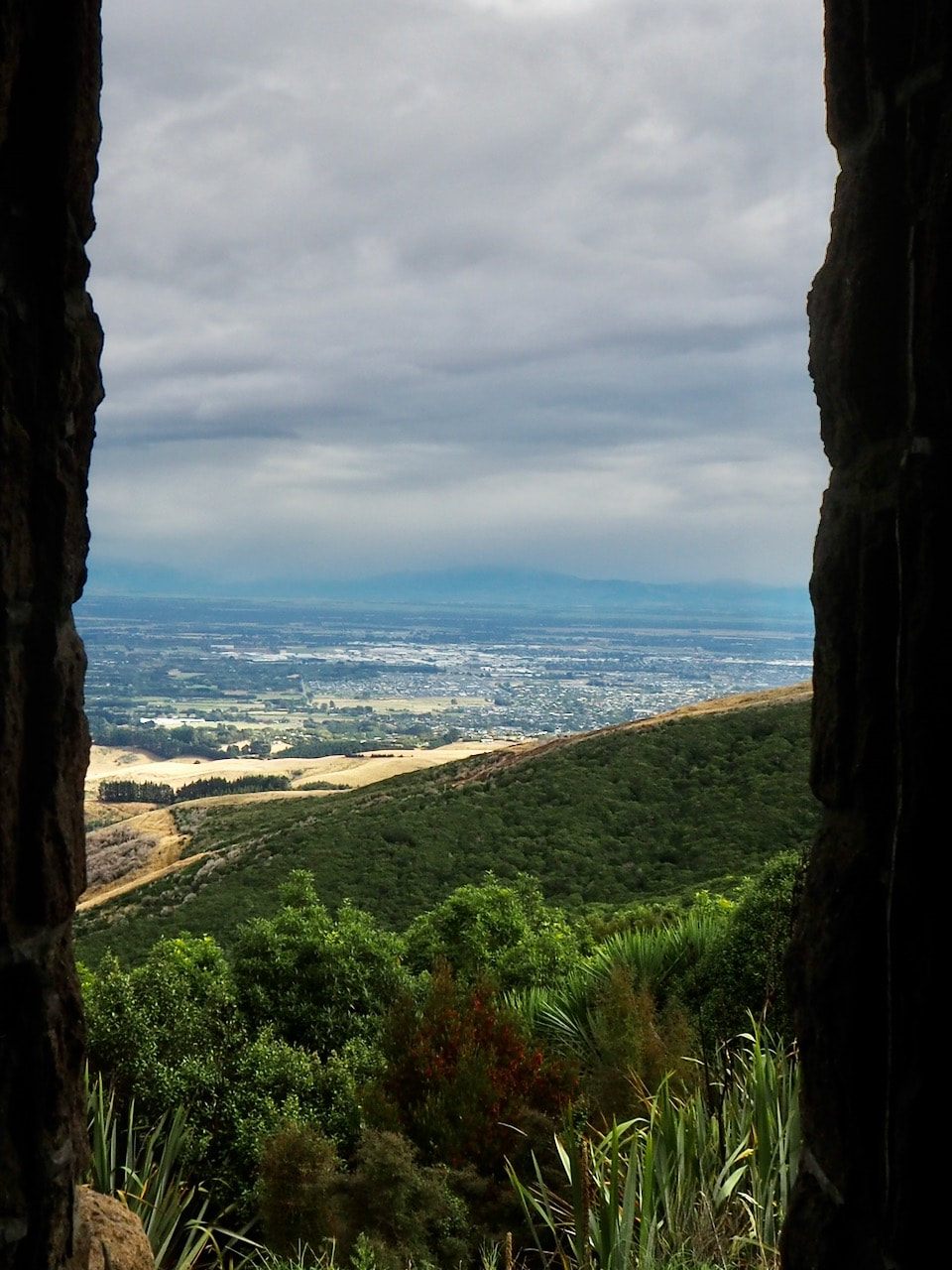
View over western Christchurch from the Sign of the Bellbird
​

Picture


Ellas Track
​One of the best ways of accessing the walks is via the Summit Road, which runs parallel with the walkway for much of its length and provides numerous parking spots.On the Summit two useful targets for any walk are The Sign of the KIwi and the Sign of the Bellbird, about 4 km apart on the western side of the crater rim. Both were built as 'refreshment stations' by the originator of the Crater Rim walk, Harry Ell, though only the Sign of the Kiwi still acts as a cafe (the Sign of the Bellbird is just a shelter, now). For that reason, a pleasant way of sampling the Rim is to start at the Sign of the Bellbird and walk north to the Kiwi, for a coffee or lunch, then return. Like other walks on the Crater Rim, this one offers great views both out of the crater - across Chrstchurch and the plains to the Oxford Hills - and into the crater, over Governors Bay to the Banks Peninsula. Despite its lofty heights, the walk is also relatively easy. The steep sections are brief, the path is generally well-formed and often soft underfoot, and there is the promise of escellent fare at the Kiwi to keepo you going.  

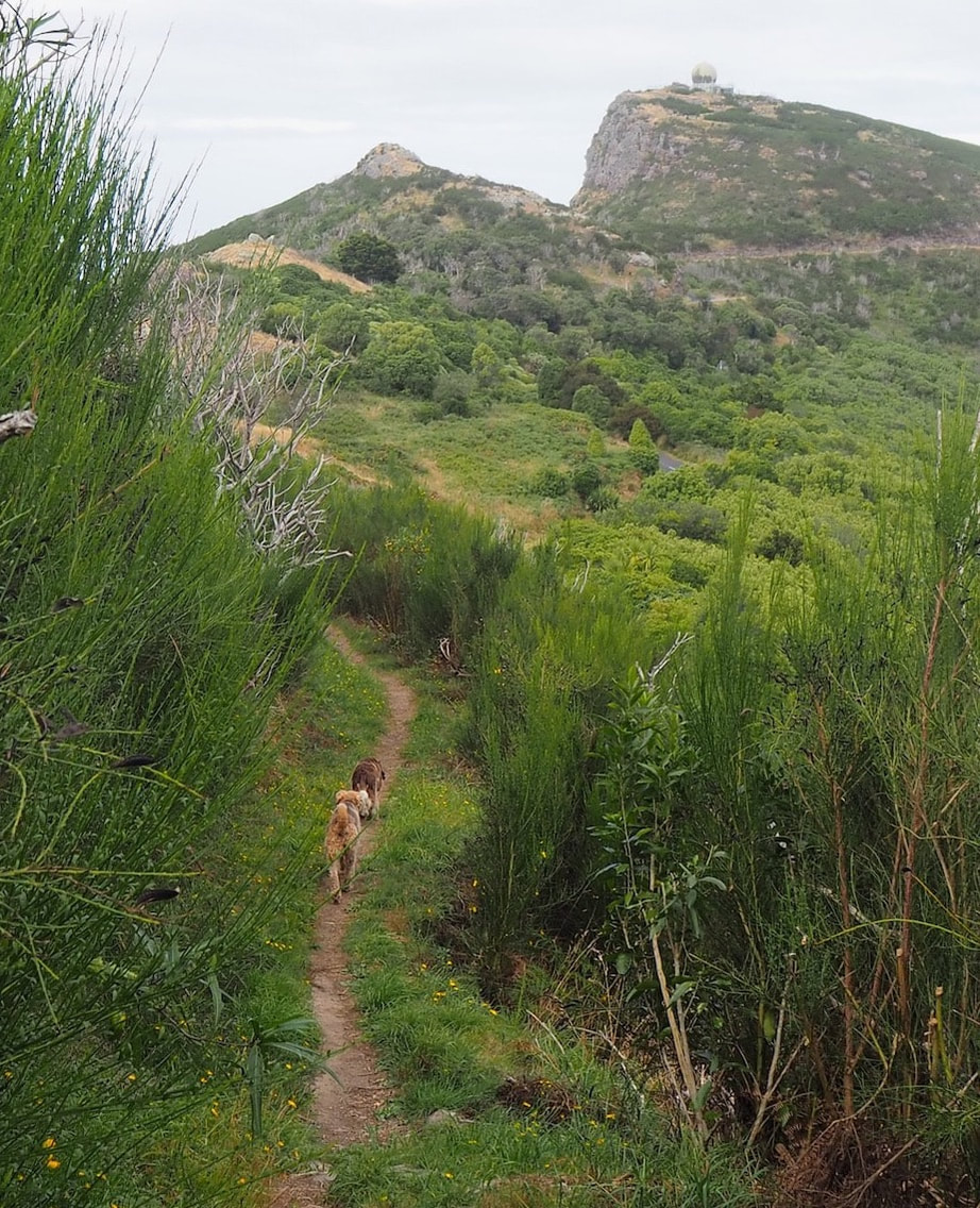
There are various ways of expanding on this walk to avoid it being a simple there-and-back experience. Near the Bellbird, for example, there are side-branches that offer either a loop or figure-of-eight walk around Coronation Hill, At the Bellbird end of the walk, there are various opportunities to dip off the ridge southwards into Ohinetahi Reserve - though if you do so, note that this is an on-leash area. One good deviation, which skirts the edge of the Reserve is Ellas Track. This starts on the east side of Summit Road, about 2 km north of the Bellbird and runs over Mount Ada, before rejoining the Crater Rim route at a small carpark. 

​
On the other side of Summit Road, Kennedy's Bush also beckons. However, don't be tempted. There are no signs about dogs at the main carpark, but when you've got your booits on and consulted the map on the information board by the shelter to work out which path you're going to take, and perhaps had a quick trip to the toilet before you set out, you get around the first corner in to the bush to find a notice saying 'No dogs'. Annoying, or what?)

​
Another option, however, is to walk south from the Sign of the Bellbird. In that direction, the track weaves along the ridgeline, ducking around peaks and bluffs, sometimes slipping into areas of bush, for six or seven kilometres until it finally stops in Ahuriri Reserve. That last step, into the Reserve, is off limits, however, for the Reserve is non-dog. But it's a rewarding walk nonetheless, for the perepsective subtly changes as you folow the track and this end of the walkway is less popular than the northern stretches, so it's possible to believe that the track is yours (and the dogs') alone.

Click on map to zoom
From the Sign of the Bellbird to The Sign of the Kiwi
If you've found this website helpful, you might also want to look at some of my novels and poetry. These, like my dog-walking, are drawn from a love of nature and the countryside. To learn more, click here.